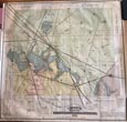
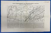
Creel's Topographical Map Of Ramsey County, Dakota Territory. HEBER CREEL First Edition. Large Color Map. 33" x 32." Scale 1.5 miles to 1." Sub-Title: Topographical Map of Ramsey County, D.T., … $750.00
December, 1897. Eastbound. Boston, Greater New York, Philadelphia, Baltimore, Washington. New England, Middle And … Sunset Tourist Excursions 8 1/2" x 32" sheet folded to 16 panels. Illustrations. Map. Schedule. Printed in black and red. Front panel offers … $150.00
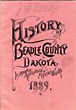
Development And Resources Of Beadle County In The New State Of South Dakota. Its … First edition. 8vo. Pink wrappers, printed in black ink, 47 [1] pp., illustrated, maps, plat. Map on verso of both … $775.00
Drawings Of Maps, Bridges, Profiles, Coal Burning Locomotives, Chairs, Brakes, Splices, & C. Accompanying … VARIOUS RAILROAD COMPANIES First Edition. Tall 8vo. Blind-stamped cloth, titles stamped in gilt on the front cover, 2 large folding maps; 44 plates … $700.00
Dritte Erganzungskarte Zum Kriegsschauplatz In Amerika (Third Supplementary Map Of The Theater Of War … A. D. GEISLER 29 x 45,7 cm. [11 1/2" x 18"] Civil War map. This German Civil War era map depicting the southern … $1,775.00
Exploring The Northwest Territory, Sir Alexander Mackensie's Journal Of A Voyage By Bark Canoe … MCDONALD, T.H. [EDITOR]. First edition. Cloth, 133 pp., illustrated. Introduction. Addenda. Bibliography. Index. 2 maps. A well-edited account of MacKenzie's first major effort … $65.00
Geography Of Louisiana To Accompany Mitchell's Intermediate Geography E. H. BUTLER AND COMPANY First edition. Quarto. 12 1/4" x 9 3/4" in sewn, printed wrappers. 12 pp. (including covers). Illustrations, map, double columns, … $125.00
Great Run Of The Last Eleven Catalogues Issued By Edward Eberstadt & Sons, Catalogues … EDWARD EBERSTADT & SONS-BOOKSELLERS First Editions. Stiff Printed Wrappers. Catalogue 158: California Delineated. 86pp., 430 Entries. Catalogue 159: California Manuscripts. 96pp., 192 Entries. Catalogue … $400.00
G. Woolworth Colton's Railroad, Township & Distance Map Of New England With Adjacent Portions … G. WOOLWORTH COLTON A remarkably well preserved - and obviously unused - Colton pocket map of railroads through New England, upstate New York, … $2,250.00
Historical Map Of Pennsylvania. Showing The Indian Names Of Streams, And Villages, And Paths … SHEAFER, P. W. AND OTHERS [EDITED BY] First edition. 8vo Black linen covers, title printed in gilt on the front cover, [6], 26 pp., map attached to … $3,500.00
History Of The Expedition Under The Command Of Lewis And Clark, To The Sources … COUES, ELLIOTT [EDITOR] First edition. 4 Volumes. #539 of a numbered set limited to 1,000 copies. Attractively rebound in Three-Quarter Leather with decorative … $6,500.00
Houston And Galveston S.H. Kress & Company First edition. 8" x 10" in green wrappers with title in gold lettering. [32] pp. Illustrations. Brief information bout Houston … $650.00
Ide's Map Of Helena, Montana, 1888 REEDER, GEORGE K. & HELMICK, CHARLES W. Map is 53.5 x 75.5 cm [21 1/8" x 29 3/4"] printed in red and black ink and folds to … $1,500.00
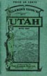
Index To Map Of Utah THE CLASON MAP COMPANY 6 1/4" x 4" green pictorial stiff wrappers printed in black, 32 pp., index to Utah towns, rivers and creeks, … $195.00
Isle Of Pines West Indies. Havana To Isle Of Pines Isle Of Pines Steamship Company (?) First edition. 6" x 3 1/2" in color pictorial wrappers, printed in orange, brown & teal. 20 pp. Illustrations. Map. … $350.00
Joint Report Upon The Survey And Demarcation Of The Boundary Between The United States … U. S. GOVERNMENT PUBLISHING OFFICE] 4to, pp. xiv, 621, [1]; photo-reproductive text illustrations throughout, three folding maps; full green cloth gilt; ex-US Airforce Library with … $5,500.00
Journal Of An Exploring Tour Beyond The Rocky Mountains, Under The Direction Of The … PARKER, A.M., REV SAMUEL First Edition. 8vo. Original Green Decorated Cloth. xii, 13 - 371 pp., Preface, One Plate, Large Folding Map. Howes P89 … $1,250.00
Just Kids. Notice - Use The Rubage Can - Keep The Street Clean. No. … INC MCLOUGHLIN BROS First edition. 13 1/4" x 9 3/4" in heavy stock pictorial covers. [16] pp. including covers. Three-color text. McLoughlin Brothers … $250.00
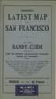
Kohnke's Latest Map Of San Francisco KOHNKE PRINTING COMPANY First edition. 7 1/8" x 4 1/8" stiff printed wrappers, 44 pp. plus 4 pp. for memorandum, map, index. Includes … $150.00
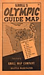
Kroll's Olympic Guide Map KROLL MAP COMPANY [EDWIN C. POLLAND, CARTOGRAPHER] First Edition. Softcover. Pocket map, opens to 22" x 33", printed in blue, red, and black. Folds into pictorial card … $125.00
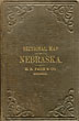
Large, Handsome, Color Map Of Nebraska CHARLES BREWSTER First edition. 11 x 17 cm. [4 3/8" x 6 3/4"] original brown, cloth binder, blind stamped, with titles stamped … $2,500.00
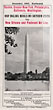
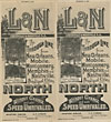
L&N, The Through Line From New Orleans, Mobile, Montgomery, Memphis And Nashville. To Principal … Louisville & Nashville Railroad 18" x 32" sheet that opens to a map of most of the country, beige outlining, inset maps and descriptions … $750.00
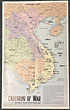
Map: Cauldron Of War. Vietnam Is World's Worst Trouble Spot NEWS SYNDICATE NEW YORK SUNDAY NEWS 21 1/2" x 13" color news map done by staff artist Edwin I. Sundberg. "This color map of Vietnam and … $925.00
Map Of Alaska, Showing Known Gold-Bearing Rocks With Descriptive Text Containing Sketches Of The … EMMONS, S. F. [GEOLOGIST] First edition. 8vo. Printed wrappers, 44 pp., introduction, color folding map. The beautiful, color map unfolds to approximately 25" x … $1,200.00
Map Of Canadian Rockies And The Triangle Tour Of British Columbia, Alaska And The … CANADIAN NATIONAL RAILWAYS First edition. Large 30 1/2" x 17" two-sided color, pictorial map. One side provides a color map of Alaska and … $325.00
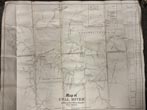
Map Of Coal River In Kanawha And Boone Counties, West Virginia. From Surveys Made … Rosencrans, William S. 30 1/2" x 24 1/2," backed with linen. A rare map showing county boundaries, coat companies, locks and dams, names … $1,995.00
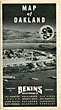
Map Of Oakland Compliments Of Bekins Van & Storage Co., Oakland, California 18" x 20" sheet folded to 16 panels. Illustrations. Map. Printed in black and white. 1 cover panel offering a … $55.00
Map Of Oregon And Upper California Fremont, John Charles Large Folding Map. 29.5" wide x 36" long. From the Surveys of John Charles Fremont and Other Authorities. Drawn by … $1,850.00
Map Of Oregon And Upper California From The Surveys Of John Charles Fremont And … CHARLES PREUSS Map 49 cm x 42 cm [19.5" x 16.5"] on a single sheet [61 cm x 47 cm] / [24" … $2,500.00