Dealer in Rare and First-Edition Books: Western Americana; Mystery, Detective, and Espionage Fiction
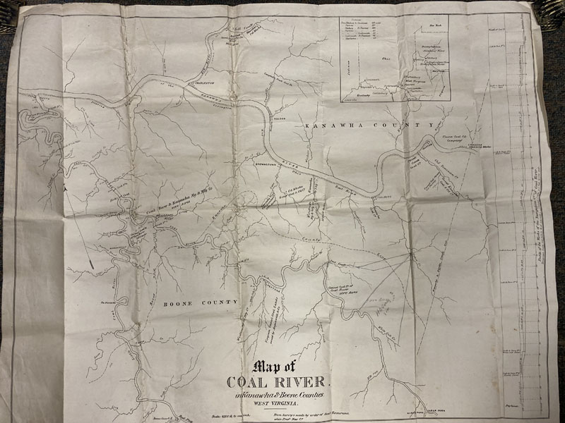
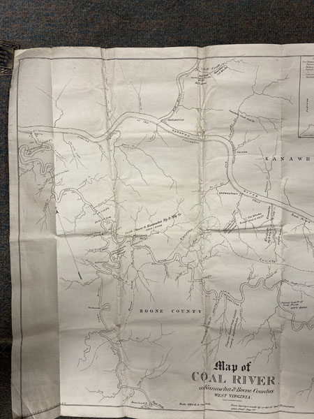
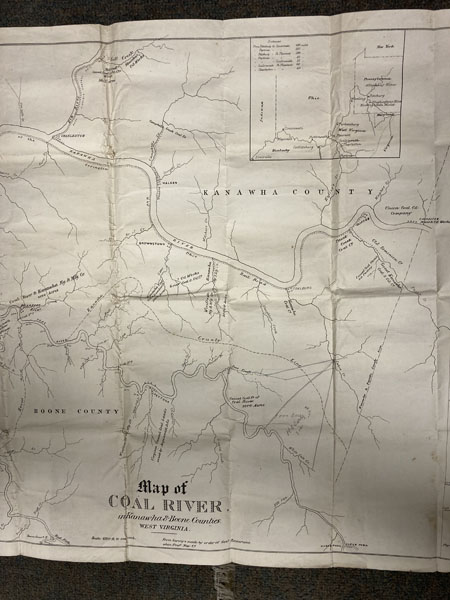
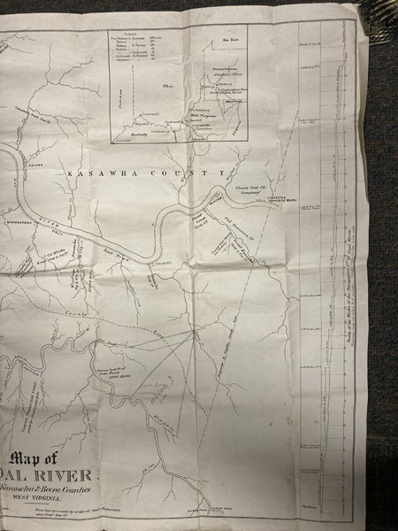
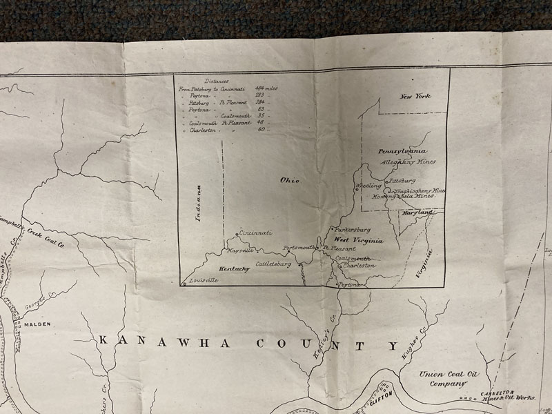
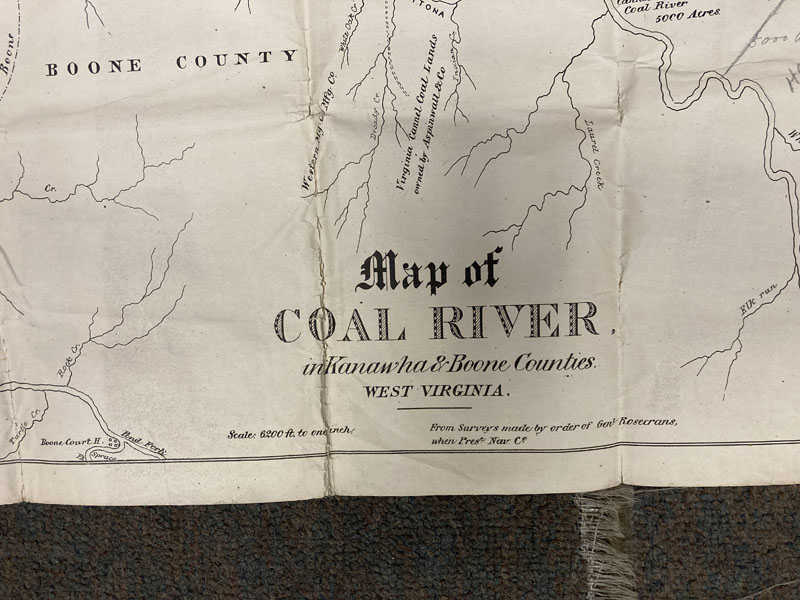
Map Of Coal River In Kanawha And Boone Counties, West Virginia. From Surveys Made By Order Of Genl. Rosecrans, When Prest. Nav. Co.
Rosencrans, William S.
Other works by Rosencrans, William S.Publication: GS Nesbitt & Co, Lith 1875, New York
30 1/2" x 24 1/2," backed with linen. A rare map showing county boundaries, coat companies, locks and dams, names of towns, railroads, and other points of interest. Several of the coal companies designated are Cannel Coal Co. of Coal River (1500 acres), Coal River and Kanawha Mg. and Mfg. Co. (4000 acres); Kanawha Coal Oil and Lumber Co. (3000 acres); Mill Creek Cannel Coat and Oil Co. (1800 acres); Great Kanawha Coal and Oil Co.; Paint Creek Coal Co.; Union Coal Co.; and Cannelton Mines and Oil Works. An inset map shows distances between Pennsylvania, Virginia, and West Virginia. With a profile of the Works of the Navigation Co. of Coal River. Rosecrans had served as President of the Coal River Navigation Company before the War. He ordered the surveys from which this map was completed. Light wear. Very good.
Inventory Number: 49016$1,995.00