Dealer in Rare and First-Edition Books: Western Americana; Mystery, Detective, and Espionage Fiction
Travel Map & Guide To Chicago's Attractions - Fide The "L" Above Conestion
Rapid Transit Lines
Other works by Rapid Transit LinesPublication: Rapid Transit Company, 1933, Chicago
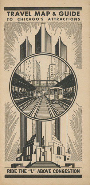
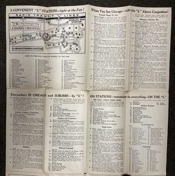
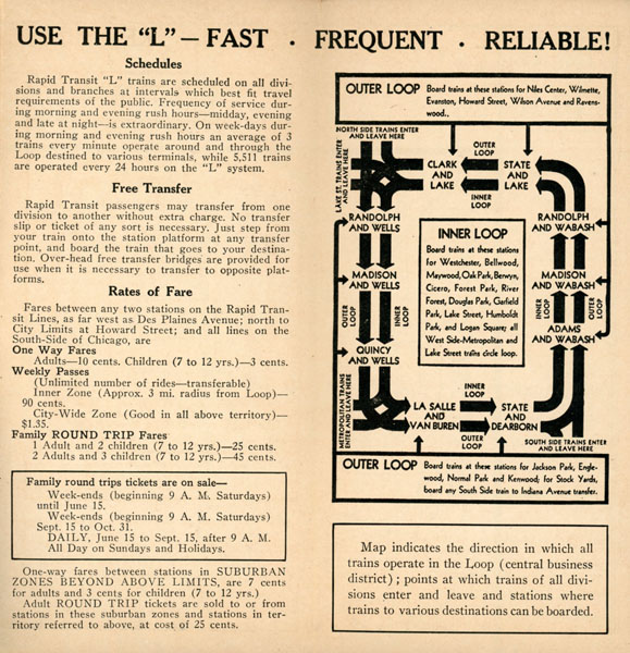
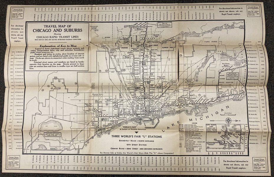
1933 Chicago map for Century of Progress. 21" x 13 3/4" sheet folded to 24 panels. Travel map of Chicago and suburbs showing Chicago rapid transit lines, with surface lines and electric inter-urban railroad connections. A very interesting and informative map, issued in conjunction with the 1933 Century of Progress Exhibition, highlights a critical cog in the wheel of urban transit ... the Chicago Rapid Transit Lines. These elevated electric railways, known colloquially as the “L,” extended well into the outer suburbs and provided an affordable, convenient way to access the fair. An inset map in the lower right shows details of the Loop, with additional details on the complicated inner and outer systems provided on the verso. On the verso are a diagram of the fairgrounds, information on local attractions, and a list of Rapid Transit stations. 9" split to fold along with 3 - 1" splits to folds. Fragile at folds. Very good.
Inventory Number: 49830$175.00
![Typically Texian. Being A Collection Of "Dog-Run" Sayings And Doings By The Lazy Easers Of English 342 DAY, DONALD AND J. FRANK DOBIE [EDITORS]](/media/images/thumb/48669.jpg)