Dealer in Rare and First-Edition Books: Western Americana; Mystery, Detective, and Espionage Fiction
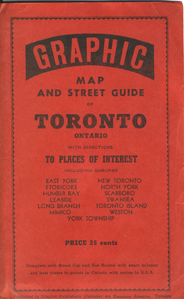
Graphic Map And Street Guide Of Toronto Ontario With Directions To Places Of Interest Including Suburbs East York, New Toronto, Etobicoke, North York, Humber Bay, Scarboro, Leaside, Swansea, Long Branch, Toronto Island, Mimico, Weston, York Township
American News Company Limited
Other works by American News Company LimitedPublication: Graphic Publishers, nd ca 1953, Toronto
28" x 34" map, printed in blue ink and housed in 8" x 5" red printed covers. Map shows street car and bus routes with exact mileage and best routes to points in Ontario with routes to U.S. Also shows railroads. Inset is a 6" x 8 1/2" map of the Township of North York and a 6" x 8 1/2" map of Etobicoke. Obverse offers an index. Light bleeding of front cover onto top of back side of map and with wear to the extremities of the over-sized red covers. Very good.
Inventory Number: 37105Sold -- Contact us