
Dealer in Rare and First-Edition Books: Western Americana; Mystery, Detective, and Espionage Fiction
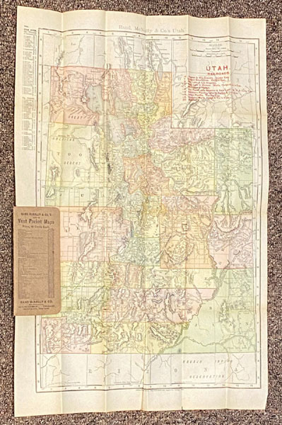
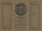
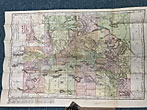
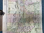
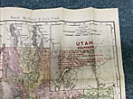
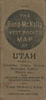
The Rand-Mcnally Vest Pocket Map Of Utah Showing All Counties, Cities Towns, Railways, Lakes, Rivers, Etc. - Population Is Given According To The Latest Official Census
Rand Mcnally & Company
Other works by Rand Mcnally & CompanyPublication: Rand McNally & Co, 1909, Chicago and New York
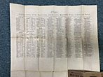
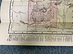
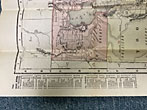
21" x 14" folding color map housed in folding 5 1/2" x 2 1/2" folding stiff brown wrappers. Counties on map shown in different colors. Railways shown include Denver & Rio Grande, Oregon Short Line, Salt Lake & Mercur, Salt Lake & Ogden, San Pedro, Los Angeles & Salt Lake, Southern Pacific, Union Pacific, Uintah, and Western Pacific. Listed at edge of map are cities. On verso is a listing of counties, creeks, Indian Reservations, islands, lakes, mountains, rivers, valleys and towns and their location on the map. Three small splits at folds of map along with light wear to wrappers. Very good.
Inventory Number: 48549Sold -- Contact us![Voice Of The Mexican Border. SHIPMAN, JACK [EDITOR]](/media/images/thumb/46335.jpg)

![Letter To R. E. Cofer On The "Dry" Versus The "Wet" Counties Of Texas IVY, H. A. [SECRETARY, TEXAS LOCAL OPTION ASSOCIATION]](/media/images/thumb/45047.jpg)

