Dealer in Rare and First-Edition Books: Western Americana; Mystery, Detective, and Espionage Fiction
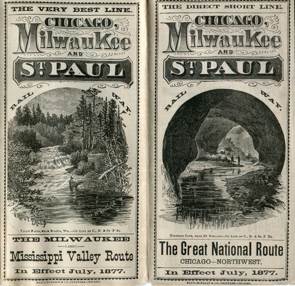
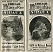
The Direct Short Line. Chicago, Milwaukee And St. Paul Railway. The Great National Route. Chicago - Northwest. In Effect July, 1877
Chicago, Milwaukee And St. Paul Railway
Other works by Chicago, Milwaukee And St. Paul RailwayPublication: Rand, McNally & Co, 1877, Chicago
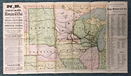
13 1/2" x 24" sheet folded to 28 panels. 2 cover panels, one showing an illustration of Fountain Cave near Ft. Snelling and the other showing an illustration of Trout Falls near Sparta, Wisconsin. A 4" x 6" street map of the business district of Chicago; information about the railway and how to obtain tickets, and 8 panels of time schedules. Opposite 14 panels offer a 12 1/2" x 16" color map of Dakota, Minnesota, Wisconsin, Nebraska, Iowa, Illinois, Western Indiana, Northern Missouri, Northern Kansas, and Northeastern Colorado. Along edges of map is information about the railway being the only company offering travel from Chicago or Milwaukee to St. Paul or Minneapolis as well as being the only railway offering routes to various summer resorts and business centers. Listing of stations on the line of the Chicago, Milwaukee & St. Paul Railway in Wisconsin, Minnesota, Illinois, and Iowa. Near fine.
Inventory Number: 41880Sold -- Contact us
Related Books