Dealer in Rare and First-Edition Books: Western Americana; Mystery, Detective, and Espionage Fiction
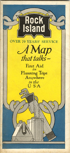
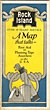
Rock Island, Over 79 Years' Service. A Map That Talks - First Aid In Planning Trips Anywhere In The U.S.A.
CHICAGO, ROCK ISLAND & PACIFIC RAILWAY
Other works by CHICAGO, ROCK ISLAND & PACIFIC RAILWAYPublication: Poole Bros, Inc, 1932, Chicago
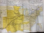
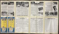
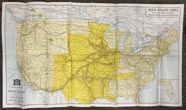
First edition. 32" x 18" sheet, folded to 9" x 4." One side opens to a color map of the United States that beginning in Chicago, Memphis, St. Louis and Minneapolis/St. Paul the Rock Island Lines serve 14 Western states over 8,000 miles of modern railroad. The route travels in a southwest direction and ends in Los Angeles and San Francisco. The other side consists of 16 panels, some-of which point out the advantages of visiting Colorado vacation resorts, Arizona and Southern California desert resorts, and Northern California resorts. Numerous views of Colorado, Arizona, and California are shown. The remaining panels encourage the traveler to use this map as their guide for every trip, where to go and what to see, Rock Island travel bureau locations, etc. Minor soiling to front cover else a fine copy and an attractive, unused map.
Inventory Number: 39896Sold -- Contact usRelated Books