Dealer in Rare and First-Edition Books: Western Americana; Mystery, Detective, and Espionage Fiction
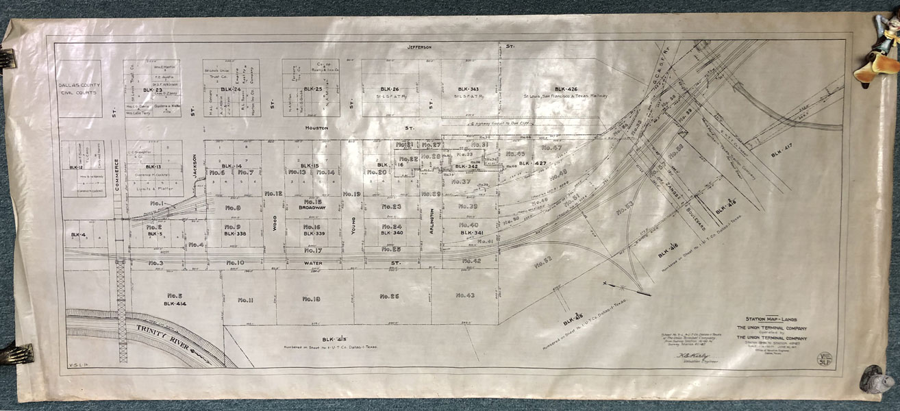
Right-Of-Way And Track Map/Station Map - Lands
THE UNION TERMINAL COMPANY
Other works by THE UNION TERMINAL COMPANYPublication: NP, June, 1917, NP
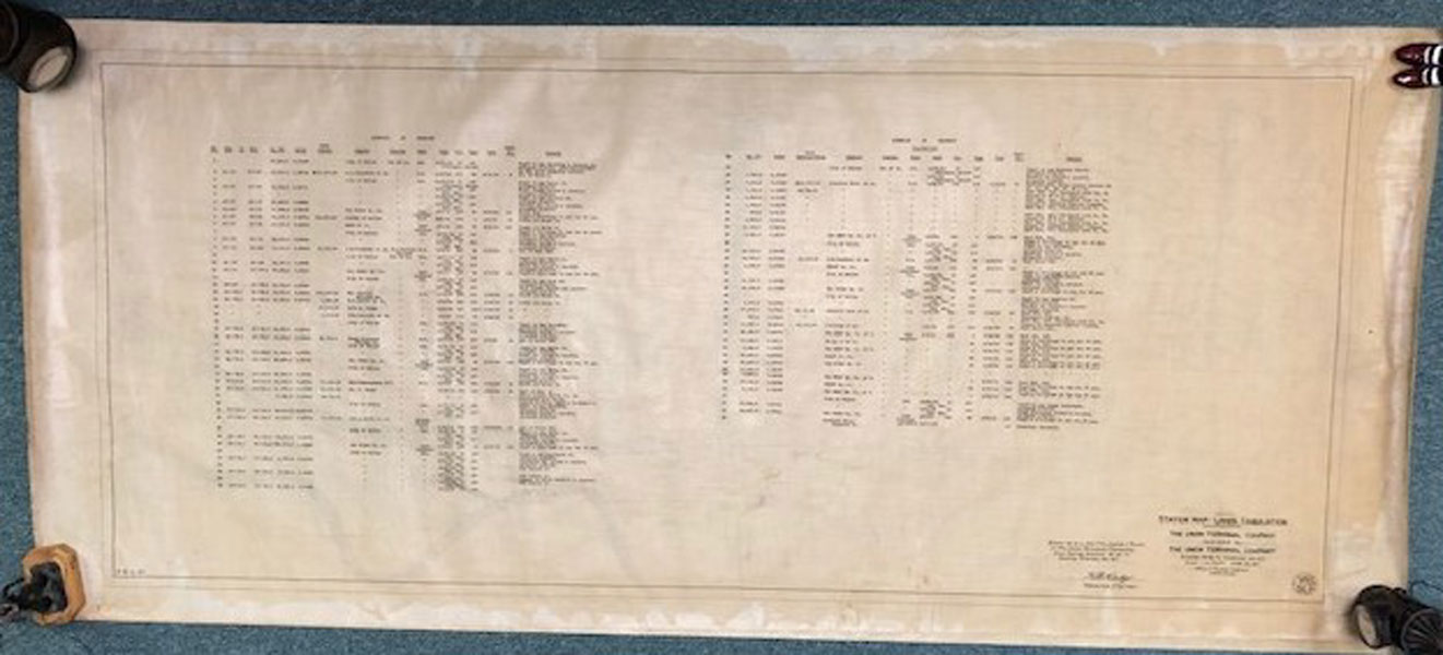
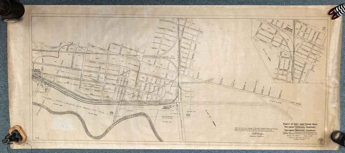
Two 60" x 27" black and white maps of Downtown Dallas, Texas, showing the area just north of the Trinity River, showing the location of the Downtown Railway Station and neighboring community streets, etc. Printed on cloth. Map #1. Station Map - Lands. Operated by the Union Terminal Company. Station 18 + 80 to Station 40 + 67. Scale: 1" = 50 feet. June 30, 1917. This map covers an area in the Cedars between Cadiz Street and Cooper Street, showing the area north of the Trinity River and Lamar Street. Map #2. Right-of-Way and Track Map. Operated by the Union Terminal Company. Main Line: Station 54 + 10 to Station 102 + 38. Central Junction: Station 0 + 65 to Station 8 + 13. Scale: 1" = 200 feet. June 30, 1917. Signed by the Office Valuation Engineer, Dallas, Texas. This map covers an area in Downtown Dallas, from Commerce in the north to today's Canton Street, showing the Bridge across Commerce and the names of numerous larger property owners. Sheet. Station Map - Lands Tabulation. Operated by the Union Terminal Company. Station 18 + 80 to Station 40 + 67. Scale: 1" = 50 feet. June 30, 1917. Signed by the Office Valuation Engineer, Dallas, Texas. This sheet shows a tabulation of the lands acquired for the Railways Station. All sheets are near fine with creasing at edges of paper. Rare.
Inventory Number: 46008$2,750.00