Dealer in Rare and First-Edition Books: Western Americana; Mystery, Detective, and Espionage Fiction
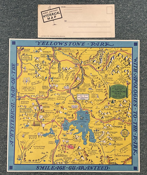
A Hysterical Map 0f The Yellowstone Park
JOLLY LINDGREN
Other works by JOLLY LINDGRENPublication: Lindgren Brothers, 1936, Spokane
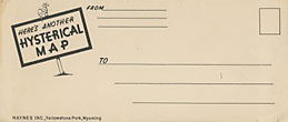
16 3/8" x 16" pictorial color map of Yellowstone Park., plus the original mailing envelope. Charming illustrated map showing the auto routes through the park and marking the attractions, including the lakes, geysers, peaks (with elevations) and lodgings. One of two maps the Lindgren's produced of Yellowstone, and although presented in a jokey manner, is surprisingly accurate and useful. "Hatched & scratched by Jolly Lindgren" The Lindgren brothers of Spokane, Washington, were commercial sign makers through the 1920s, as the economic depression of the 1930s took hold in the once prosperous Pacific Northwest, Jolly Lindgren began drawing maps of western National Parks (Yosemite, Yellowstone, Zion, Bryce, Grand Canyon, Rocky Mountain and others) sites and towns (Death Valley, Grand Coulee, Lake Tahoe, Jackson Hole, Black Hills, Puget Sound, Palm Springs) and western states (Washington, Oregon, Montana, California, Utah and likely others). These whimsical maps were named 'Hysterical Maps' and included many jokes and puns. These maps proved to be quite successful and were produced through the 1940s. Faint fold creases else a near fine copy.
Inventory Number: 47466Sold -- Contact us