Dealer in Rare and First-Edition Books: Western Americana; Mystery, Detective, and Espionage Fiction
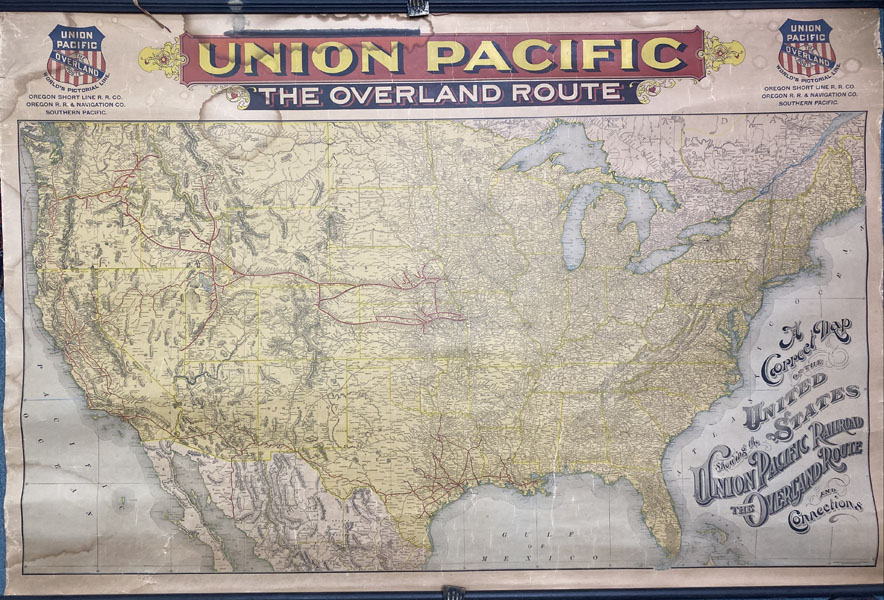
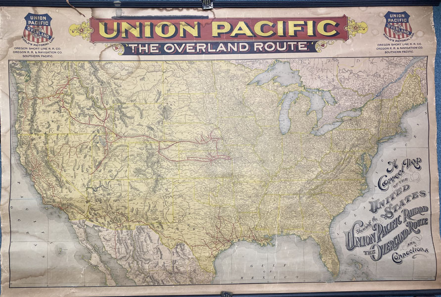
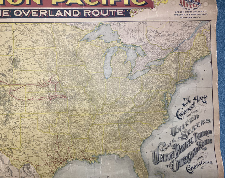
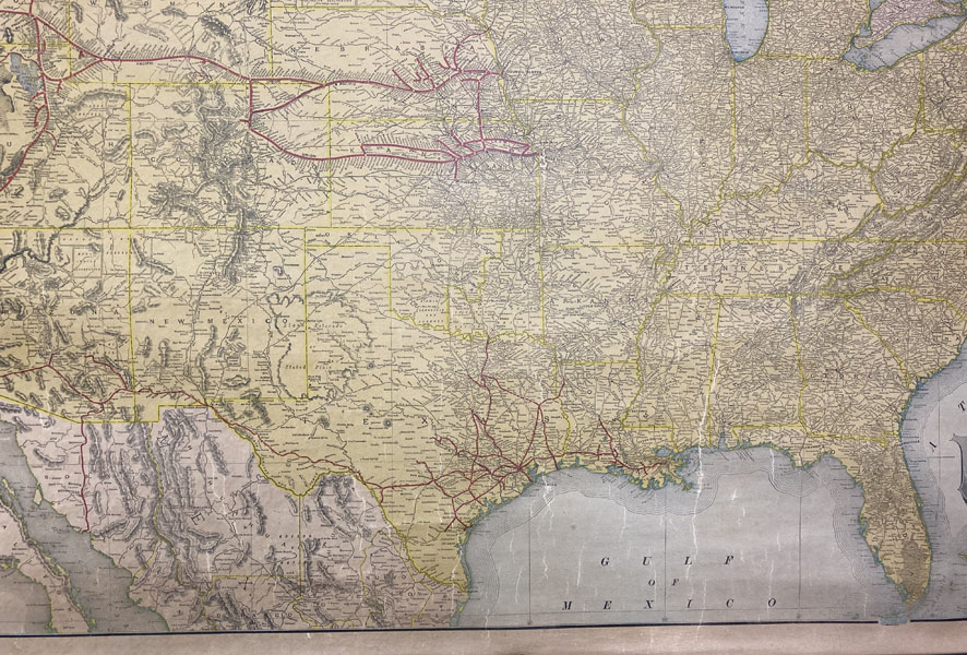
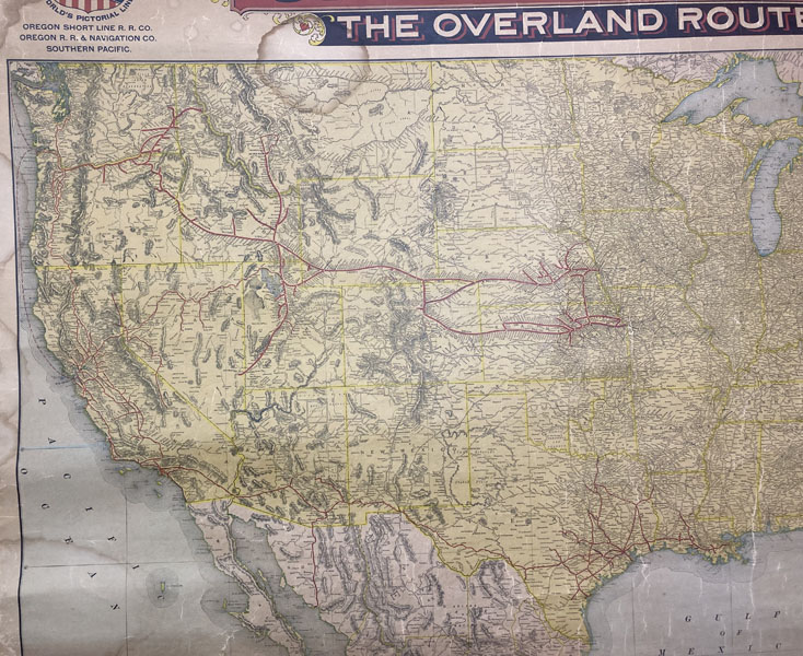
A Correct Map Of The United States Showing The Union Pacific Railroad, The Overland Route And Connections
UNION PACIFIC RAILROAD COMPANY
Other works by UNION PACIFIC RAILROAD COMPANYPublication: Rand McNally & Co, 1896, Chicago
Oblong atlas folio. 37 x 56 in. One large color lithograph map mounted on linen, showing the routes of the Union Pacific and subsidiary railroads in red, with red, yellow & black banner style lettering at upper fore-edge, Union Pacific shields with mentions of subsidiary Railways, mounted to upper & lower wooden rods as issued (some minor lifting & creasing from being rolled over the years, minor tide mark at left fore-edge, upper fore-edge, minor fraying, and darkening), still nice complete example of this map. First Rand, McNally & Co. edition, thus, of this uncommon First Rand, McNally & Co. edition, thus, of this uncommon Union Pacific Railroad route map intended to be used by travel agents, and passenger agents in Union Pacific stations across the West. The map demarcates the Overland Route, and connections with the Oregon Short Line RR Co., Oregon RR & Navigation Co., and the Southern Pacific in bold red stretching West from Kansas City, Leavenworth, St. Joseph, Omaha, Council Bluffs, Sioux City, & Fort Worth. A version of this map was initially released in 1892 by Reeves with the Knight, Leonard & Co., and a little larger by a couple inches as it included insets for Sandwich Islands, and Alaska, whereas this version focuses only on the Continental United States.
Inventory Number: 49745$1,875.00
![The World Of Andy Anderson ANDERSON, ANDY [CARVER]](/media/images/thumb/47729.jpg)
![Hotel Utah. The Hotel Beautiful. Salt Lake City RELF, GEO O. [MANAGING DIRECTOR]](/media/images/thumb/48962.jpg)