Dealer in Rare and First-Edition Books: Western Americana; Mystery, Detective, and Espionage Fiction
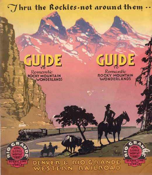
Thru The Rockies - Not Around Them -- Guide To Romantic Rocky Mountain Wonderlands
Denver & Rio Grande Western Railroad
Other works by Denver & Rio Grande Western RailroadPublication: Privately printed, nd ca 1935, Denver
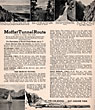
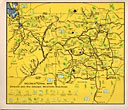
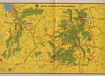
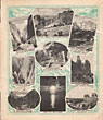
First Edition. 8 3/4" x 7 3/4" in color pictorial wrappers showing cowboys on their horses in foreground and a train and the mountains in the background. 78 columns of text (two per page), illustrations, maps. Overview of the Denver & Rio Grande Western Railroad, Colorado, Utah and New Mexico, followed by information on the Royal Gorge Route, Denver, Littleton, Castle Rock, Colorado Springs, Cripple Creek, Pueblo, Florence, Canon City the Royal Gorge, Salida, Buena Vista, Leadville, Red Cliff, Dotsero, the Moffat Tunnel Route, the Moffat Tunnel, Granby, Hot Sulphur Springs, Gore Canyon, Bond, the Royal Gorge and Moffat Tunnel Routes, Glenwood Springs, Carbondale, Aspen, Redstone, Rifle, Montrose, Black Canyon National Monument, Fruita, Mack, Walsenburg, Trinidad, La Veta, Alamosa, the San Luis Valley, the Great Sand Dunes National Park, Monte Vista, La Jara, Antonito, Silverton, Marshall Pass, Gunnison, Ouray, etc. (COLORADO); Westwater, Thompson, Green River, Mounds, Price, Helper, Castle Gate, Soldier Summit, Springville, Salt Lake City, Layton, Ogden, Park City, Mount Pleasant, Ephraim, Nephi, Marysvale, etc. (UTAH); Embudo, Espanola, Santa Fee, Toltec, Ignacio, Mesa Verde National Park, Farmington, etc. (NEW MEXICO). Numerous black and white photographs and illustrations throughout. Double-page color system map at center, also showing national forests, parks, and monuments. One-page color recreational map; one-page color industrial map. Light scraping to covers along with light soiling and wear to the extremities. Very good.
Inventory Number: 43581Sold -- Contact us