Dealer in Rare and First-Edition Books: Western Americana; Mystery, Detective, and Espionage Fiction
![The Official State Atlas Of Kansas, Compiled From Government Surveys; County Records And Personal Investigations. EVERTS, L. H. [PUBLISHER]](/media/images/large/42443.jpg)
![The Official State Atlas Of Kansas, Compiled From Government Surveys; County Records And Personal Investigations. EVERTS, L. H. [PUBLISHER] - Image 2](/media/images/large/42443_9.jpg)
![The Official State Atlas Of Kansas, Compiled From Government Surveys; County Records And Personal Investigations. EVERTS, L. H. [PUBLISHER] - Image 3](/media/images/large/42443_8.jpg)
![The Official State Atlas Of Kansas, Compiled From Government Surveys; County Records And Personal Investigations. EVERTS, L. H. [PUBLISHER] - Image 4](/media/images/large/42443_7.jpg)
![The Official State Atlas Of Kansas, Compiled From Government Surveys; County Records And Personal Investigations. EVERTS, L. H. [PUBLISHER] - Image 5](/media/images/large/42443_6.jpg)
![The Official State Atlas Of Kansas, Compiled From Government Surveys; County Records And Personal Investigations. EVERTS, L. H. [PUBLISHER] - Image 6](/media/images/large/42443_5.jpg)
![The Official State Atlas Of Kansas, Compiled From Government Surveys; County Records And Personal Investigations. EVERTS, L. H. [PUBLISHER] - Image 7](/media/images/large/42443_4.jpg)
![The Official State Atlas Of Kansas, Compiled From Government Surveys; County Records And Personal Investigations. EVERTS, L. H. [PUBLISHER] - Image 8](/media/images/large/42443_30.JPG)
![The Official State Atlas Of Kansas, Compiled From Government Surveys; County Records And Personal Investigations. EVERTS, L. H. [PUBLISHER] - Image 9](/media/images/large/42443_3.jpg)
![The Official State Atlas Of Kansas, Compiled From Government Surveys; County Records And Personal Investigations. EVERTS, L. H. [PUBLISHER] - Image 10](/media/images/large/42443_29.JPG)
![The Official State Atlas Of Kansas, Compiled From Government Surveys; County Records And Personal Investigations. EVERTS, L. H. [PUBLISHER] - Image 11](/media/images/large/42443_28.jpg)
![The Official State Atlas Of Kansas, Compiled From Government Surveys; County Records And Personal Investigations. EVERTS, L. H. [PUBLISHER] - Image 12](/media/images/large/42443_27.jpg)
![The Official State Atlas Of Kansas, Compiled From Government Surveys; County Records And Personal Investigations. EVERTS, L. H. [PUBLISHER] - Image 13](/media/images/large/42443_26.jpg)
![The Official State Atlas Of Kansas, Compiled From Government Surveys; County Records And Personal Investigations. EVERTS, L. H. [PUBLISHER] - Image 14](/media/images/large/42443_25.jpg)
![The Official State Atlas Of Kansas, Compiled From Government Surveys; County Records And Personal Investigations. EVERTS, L. H. [PUBLISHER] - Image 15](/media/images/large/42443_24.jpg)
![The Official State Atlas Of Kansas, Compiled From Government Surveys; County Records And Personal Investigations. EVERTS, L. H. [PUBLISHER] - Image 16](/media/images/large/42443_23.jpg)
![The Official State Atlas Of Kansas, Compiled From Government Surveys; County Records And Personal Investigations. EVERTS, L. H. [PUBLISHER] - Image 17](/media/images/large/42443_22.jpg)
![The Official State Atlas Of Kansas, Compiled From Government Surveys; County Records And Personal Investigations. EVERTS, L. H. [PUBLISHER] - Image 18](/media/images/large/42443_21.jpg)
![The Official State Atlas Of Kansas, Compiled From Government Surveys; County Records And Personal Investigations. EVERTS, L. H. [PUBLISHER] - Image 19](/media/images/large/42443_20.jpg)
![The Official State Atlas Of Kansas, Compiled From Government Surveys; County Records And Personal Investigations. EVERTS, L. H. [PUBLISHER] - Image 20](/media/images/large/42443_2.jpg)
![The Official State Atlas Of Kansas, Compiled From Government Surveys; County Records And Personal Investigations. EVERTS, L. H. [PUBLISHER] - Image 21](/media/images/large/42443_19.jpg)
![The Official State Atlas Of Kansas, Compiled From Government Surveys; County Records And Personal Investigations. EVERTS, L. H. [PUBLISHER] - Image 22](/media/images/large/42443_18.jpg)
![The Official State Atlas Of Kansas, Compiled From Government Surveys; County Records And Personal Investigations. EVERTS, L. H. [PUBLISHER] - Image 23](/media/images/large/42443_17.jpg)
![The Official State Atlas Of Kansas, Compiled From Government Surveys; County Records And Personal Investigations. EVERTS, L. H. [PUBLISHER] - Image 24](/media/images/large/42443_16.jpg)
![The Official State Atlas Of Kansas, Compiled From Government Surveys; County Records And Personal Investigations. EVERTS, L. H. [PUBLISHER] - Image 25](/media/images/large/42443_15.jpg)
![The Official State Atlas Of Kansas, Compiled From Government Surveys; County Records And Personal Investigations. EVERTS, L. H. [PUBLISHER] - Image 26](/media/images/large/42443_14.jpg)
![The Official State Atlas Of Kansas, Compiled From Government Surveys; County Records And Personal Investigations. EVERTS, L. H. [PUBLISHER] - Image 27](/media/images/large/42443_13.jpg)
![The Official State Atlas Of Kansas, Compiled From Government Surveys; County Records And Personal Investigations. EVERTS, L. H. [PUBLISHER] - Image 28](/media/images/large/42443_12.jpg)
![The Official State Atlas Of Kansas, Compiled From Government Surveys; County Records And Personal Investigations. EVERTS, L. H. [PUBLISHER] - Image 29](/media/images/large/42443_11.jpg)
![The Official State Atlas Of Kansas, Compiled From Government Surveys; County Records And Personal Investigations. EVERTS, L. H. [PUBLISHER] - Image 30](/media/images/large/42443_10.jpg)
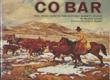
The Official State Atlas Of Kansas, Compiled From Government Surveys; County Records And Personal Investigations.
EVERTS, L. H. [PUBLISHER]
Other works by EVERTS, L. H.Publication: L H Everts & Co, 1887, Philadelphia
First edition. Folio. 18" x 15" x 3" Original calf spine and corners and cloth, titles stamped in gold gilt on the front cover, 339 numbered pages (plus many more unnumbered pages of views), preface, illustrated by hundreds of colored maps and plates in black & white. Twenty-five colored folding maps. A large 30.9 cm. x 70,9 cm. [12 1/4" x 28"] folding map.This is the first large atlas for the state of Kansas. Includes detailed county maps, many hand-colored; township and city plats, showing landowners and property boundaries; illustrations and lithographs of buildings, farms, and towns; demographic, agricultural, and economic statistics; topographic and railroad maps; etc. Six Score 83 says "These atlases were designed so that pages could be tipped in. I doubt that any two copies are exactly alike." "This massive compilation contains a vast wealth of information on Kansas at the time of publication. Many of the views depict stock ranches, which are also located on the extremely detailed maps. There are many bird's eye views of towns and sights. Much of the accompanying text is devoted to listing the leading citizens of the state, their property, what kind of livestock they raise, and even what kind of fencing they use. The Everts' atlas is an important source for much information, with illustrations existing nowhere else." Rumsey 2818 says "The views show the remarkable development of the state over two decades after the Civil War." Dorothy Sloan states, "This atlas is rich in stock raising iconography and statistics. Many of the maps, which are certified as correct by various officials, locate ranches. Because of their large scale, the maps are quite detailed and show railroads, waterways, churches, cemeteries, and various features in the towns depicted. Numerous manufacturing establishments are also shown. The lithographed scenes, which were probably paid for by the owners of the properties depicted, show numerous prosperous farms, ranches, and town residences in their rural Victorian splendor. The detailed town maps are important documentation of a time when many of them were in their infancy. The importance of railroads in town development is obvious. The large folding map at the front was the best available map of Kansas at that time." Several pages in the "content" section of pages have small chips (repaired) with minor loss of lettering, also a few minor fore-edge repairs to the margin of a few pages at the rear of the volume, and some light cosmetic restoration to the front and rear leather corners of the covers, the maps and plates are in fine, bright condition, else a very good, tight copy of a beautiful cartographic production. The coloring is bright and this is a tough book to find in even good condition because of its size and weight.
Inventory Number: 42443$8,000.00
![The Other 49ers, A Topical History Of Sanpete County, Utah ANTREI, ALBERT C. T. [EDITOR]](/media/images/thumb/47164.jpg)