Dealer in Rare and First-Edition Books: Western Americana; Mystery, Detective, and Espionage Fiction
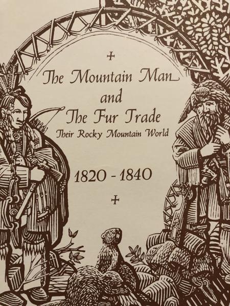
The Mountain Man And The Fur Trade, Their Rocky Mountain World 182-1840.
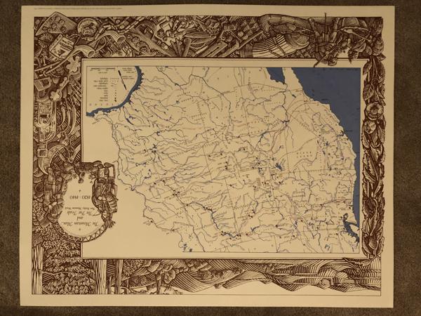
G. L. COLES-CARTOGRAPHY
Other works by G. L. COLES-CARTOGRAPHYPublication: Museum Of New Mexico, 1993, Santa Fe
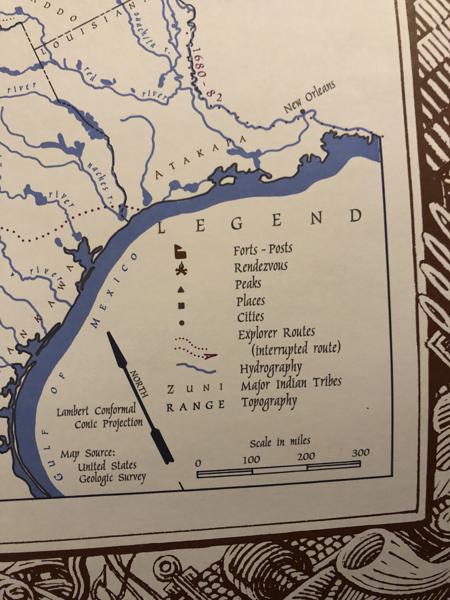
Large Map of the Trans-Mississippi West. Single, unfolded Sheet, 31" x 22", with wide, woodcut illustrated border, with Map 23" x 15.5". "This is the first full-color, full-size reproduction of the manuscript map drawn by Ferris during the Rocky Mountain rendezvous era." Originally produced in 1836, by Warren A. Ferris to accompany his journal kept during his period trapping the Rockies from 1830 to 1835. When it was finally published in 1940, in Life In The Rocky Mountains, it was greatly reduced in size and hard to read. This attractive map is prepared for framing, with a great woodcut illustrated border. The map shows "Forts-Posts, Rendezvous, Peaks, Places, Cities, Explorer Routes, Hydrography, Major Indian Tribes, Topography". The production of this map was "Funded by a Grant from the New Mexico Endowment for the Humanities and the Museum Of New Mexico Foundation, Museum Of New Mexico". A great map of the West. As New.
Inventory Number: 54416$100.00