Dealer in Rare and First-Edition Books: Western Americana; Mystery, Detective, and Espionage Fiction
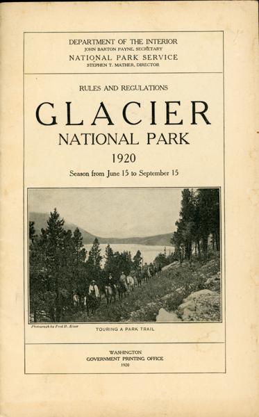
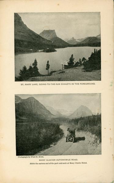
Rules And Regulations. Glacier National Park. 1920. Season From June 15 To September 15
Department Of The Interior, National Park Service
Other works by Department Of The Interior, National Park ServicePublication: Government Printing Office, 1920, Washington
9" x 5 3/4" in black and white pictorial wrappers. 62 pp., illustrations, contents, maps. Chart showing the National Parks, their locations and distinctive characteristics. General description of the park with information on Two Medicine Valley, cut Bank Valley, Red Eagle Valley, St. Mary Valley, Swiftcurrent Valley, the Kennedy Valleys, the Belly River Valley, Gunsight Pass, Swiftcurrent Pass, Logan Pass, Brown Pass. Information on how to reach the park, hotels, chalets, camps, transportation within the park, boat service, rates for trips, hotels and chalets, various trips from various hotels and chalets, fishing, swimming, various tours, wildlife, rules and regulations, etc. Map showing railroad routes to Glacier and Yellowstone National Parks; map showing automobile roads between Glacier, Yellowstone, Rocky Mountain, Mesa Verde, and Zion National Parks; map of Glacier National Park. Staple holes to edge of front wrapper along with light soiling to wrappers and with light wear to the extremities. Much valuable information.
Inventory Number: 53845$45.00
![Typically Texian. Being A Collection Of "Dog-Run" Sayings And Doings By The Lazy Easers Of English 342 DAY, DONALD AND J. FRANK DOBIE [EDITORS]](/media/images/thumb/48669.jpg)
![News Of The Plains And Rockies 1803-1865 WHITE, DAVID A. [EDITOR]](/media/images/thumb/48205.jpg)