Dealer in Rare and First-Edition Books: Western Americana; Mystery, Detective, and Espionage Fiction
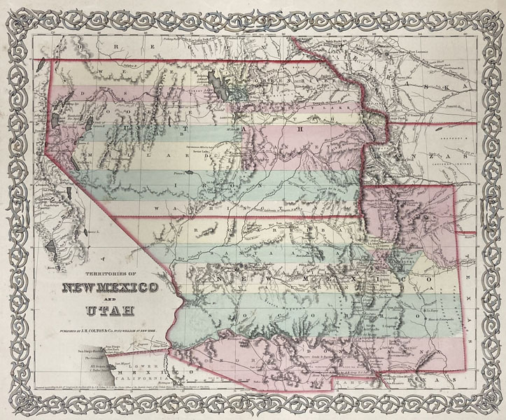
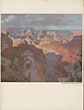
Map: Territories Of New Mexico And Utah, 1855
J. H. COLTON & COMPANY
Other works by J. H. COLTON & COMPANYPublication: Published By J H Colton & Company, 1855, New York
First edition. 11 1/8" x 14" color map (28.5 x 35.5 cm) on a 15 3/4" x 18 1/8" single sheet (40 x 46 cm). The territorial boundaries and counties have been hand-tinted and the map is within a decorative printed border. "Colton's map of New Mexico and Utah shows these two territories, with all their counties colored, as they existed in 1855 before Arizona and Nevada were lopped off on the west. Across the desert south of Great Salt Lake is Beckwith's line marked 'Route explored for Pacific R.R.,' while 'Capt. Gunnison's route' is also marked 'Route Explored for Pacific R.R.' Up the Canadian River, over to Albuquerque and west from there, reaching the Colorado River at the mouth of Bill Williams Creek, goes the Whipple trail also marked 'Explored Route for Pacific R.R.,' while the far south a line is shown coming up Delaware Creek from the Pecos River crossing over to Franklin (opposite the Mexican town of El Paso), and continuing west through the Gadsden Purchase to Camp Yuma, and marked 'Proposed Route for Pacific R.R.' The difference in the legend is significant. This was the 'Proposed Route,' while all the others were merely explored. The California "diggins" are shown in part along the edge of this map. The Genoa area of Nevada is listed as Mormon Settlement. Fillmoreis listed as the territorial capital of Utah." From Colton's Atlas of the World. Map hand-tinted colors are bright and some minor age toning to the extremities, else a very good copy.
Inventory Number: 47542Sold -- Contact us