Dealer in Rare and First-Edition Books: Western Americana; Mystery, Detective, and Espionage Fiction
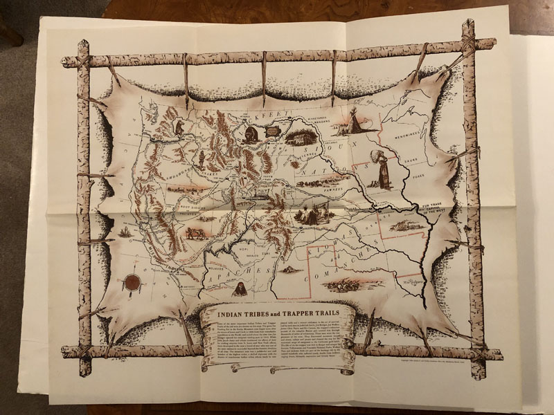

Indian Tribes And Trapper Trails
JAMES F GARDINER
Other works by JAMES F GARDINERPublication: Privately Printed, 1949, Manhattan Beach, California
First edition. 20" x 24" colored map depicting some of the more important Indian Tribes and Trapper Trails of the Old West. Map includes the Mississippi River and St. Louis as the Fur Trade Capitol of the West, on the eastern portion of the map which extends to the Pacific Ocean. Forts, missions, and explorers' routes are dated and labeled throughout. Vignettes show iconic scenes of wagon trains and buffalo herds, portraits of stoic Native American chiefs, and sun-bleached bones in the desert of Nevada. Huge swathes of territory are attributed to particular tribes. Fine copy suitable for framing, housed in the original folder that is complete with a bibliography of important books pertaining to this era. Protective folder near fine.
Inventory Number: 51216Sold -- Contact us