Dealer in Rare and First-Edition Books: Western Americana; Mystery, Detective, and Espionage Fiction
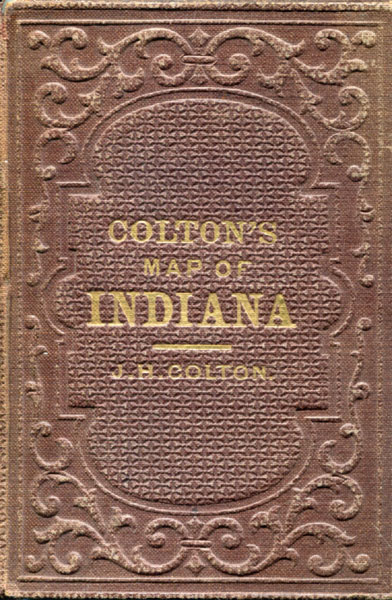
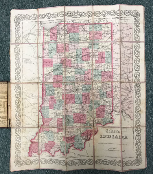
Colton's Map Of Indiana
J. H COLTON
Other works by J. H COLTONPublication: J H Colton, 1859, New York
Original Cloth. Full-color engraved map drawn by George W. Colton and engraved by J. M. Atwood, colored by hand, scrollwork border on all sides, mounted on pink linen, opens to 16.5" x 14". Folds into 5" x 3 1/4" brown cloth case with embossed all-over design on both covers, gilt lettering on front cover. A mid-19th-century engraved atlas map depicting Indiana counties, townships, railroads, canals, roads, rivers, and emerging transportation infrastructure during the pre–Civil War period.
Inventory Number: 42813$975.00

![Canada West. Canada - The New Homeland. (Cover Title) MCDONELL, D. N. [CANADIAN GOVERNMENT AGENT]](/media/images/thumb/53786.jpg)