Dealer in Rare and First-Edition Books: Western Americana; Mystery, Detective, and Espionage Fiction
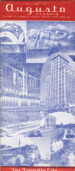
Welcome To Augusta, Georgia
Augusta, Georgia Chamber Of Commerce
Other works by Augusta, Georgia Chamber Of CommercePublication: Privately printed, nd (circa 1950), Augusta
18" x 24" large sheet folded to twenty-four 9" x 4" panels of which three are red and blue. One side is a map printed in red and blue entitled "MAP OF AUGUSTA, GA. AND SUBURBS." The map points out Keys To Points Of Interest, four tours, Public Places, and an index. The other side describes Augusta, Georgia, the population, industries, Savannah River Development, agriculture, housing, schools, county government, historic streets, climate, accommodations, highways, airports, et. al. Blue tinted pictures. Nice copy.
Inventory Number: 37849Sold -- Contact us