Dealer in Rare and First-Edition Books: Western Americana; Mystery, Detective, and Espionage Fiction
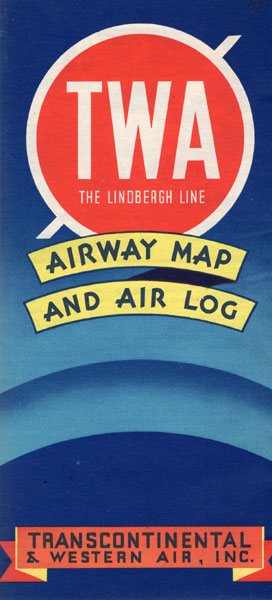
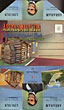
Twa - The Lindbergh Line Airway Map And Air Log
TRANSCONTINENTAL & WESTERN AIR, INC
Other works by TRANSCONTINENTAL & WESTERN AIR, INCPublication: Rand McNally & Company, 1936, Chicago
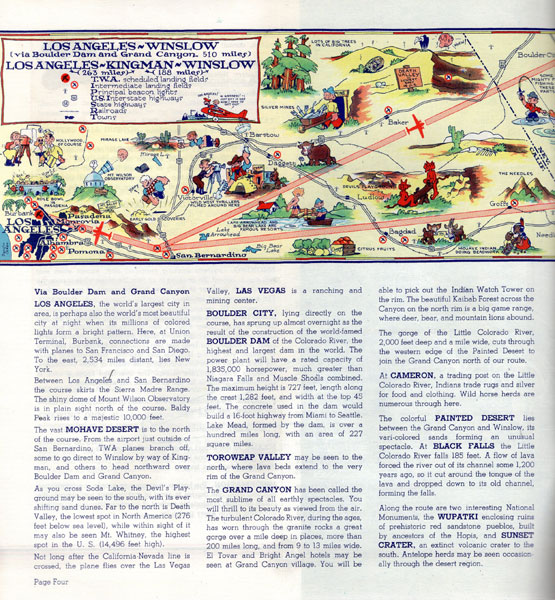
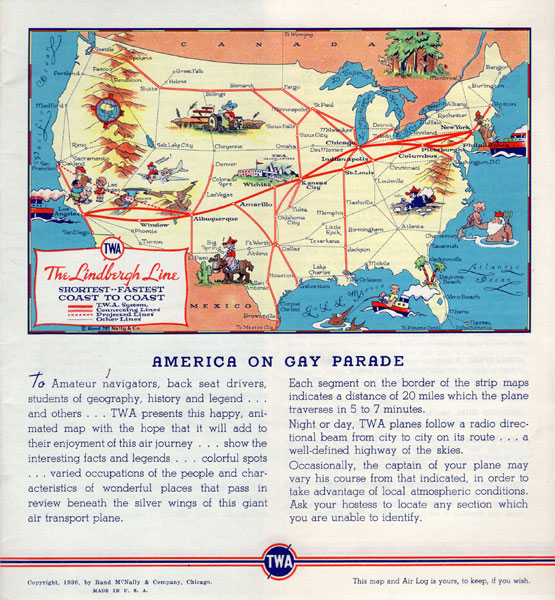
First edition. 8vo. 8 1/2" x 9" Art-Deco color, printed wrappers, folds to 4 1/4" x 9," 24 pp. (including covers), color-printed throughout, with 11 double-page color-illustrated pictorial maps, lettering printed in red, blue & white. From the library of David H. Kenyon (1918-2011) former Lockheed engineer & military sales manager, as well as aviation consultant for Pan American, TWA, and the Venezuelan Airlines, and later President of the Southern California Wing of the OX5 Aviation Pioneers. First edition of this scarce and wonderfully illustrated airway map, based on the very popular Gay Geography pictographic maps published the year before by Ruth Taylor White which inspired an entire generation of cartographic illustrators and imitators. This work opens with map showing the Lindbergh Line stretching from Los Angeles to New York, followed by pictographic maps showing humorous cartoon figures and sites across the country through Kingman, Winslow, Albuquerque, Amarillo, Wichita, Kansas City, St. Louis, Indianapolis, Columbus, Pittsburgh, Philadelphia, Chicago, and New York. Each of these maps contain small figures depicting cliche characters at work and play, including cowboys, American Indians, loggers, farmers, aviators, prisoners in Joliet, manufacturing, and more. [Worldcat locates 2 copies (NY Public Library and Newberry (Proof copy)); See: Griffin, Mapping Wonderlands: Illustrated Cartography, pp. 192-193]. Near fine, bright copy of a scarce title.
Inventory Number: 43666$650.00
Related Books