Dealer in Rare and First-Edition Books: Western Americana; Mystery, Detective, and Espionage Fiction
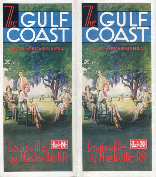
The Gulf Coast, The American Riviera
Louisville & Nashville Railroad
Other works by Louisville & Nashville RailroadPublication: Poole Bros Inc, 1930, Chicago
Sixty-four panels, 4 per page, doubled twice to 9" x 4" in bright color pictorial wrappers with a golf scene. Illustrations. Maps. A beautiful 8-panel color panoramic map at center. Map dated 1926 by Poole Bros., Inc. 2-panel system map showing railway lines from Cincinnati and St. Louis south to Atlanta, Pensalcola and New Orleans. Map dated 1930 by Poole Bros., Inc. Text discusses resort areas of Pensacola, Perdido Bay District, Santa Rosa Sound, Choctawhatchee Bay District, St. Andrew's Bay District, Panama, Chipola Lake District, Apalachicola Bay District, Mobile, Biloxi, Beauvoir, Gulfport, Long Beach, Pass Christian, Bay St. Louis, over to New Orleans, with numerous black and white photographs of points of interest in each area. Listing of area golf courses, hotels and boarding houses. Bright brochure with minimal soiling to wrappers.
Inventory Number: 43007Sold -- Contact usRelated Books