Dealer in Rare and First-Edition Books: Western Americana; Mystery, Detective, and Espionage Fiction
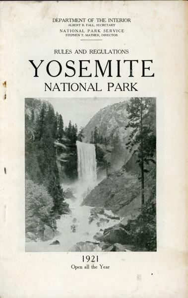
Rules And Regulations. Yosemite National Park. 1921. Open All The Year
Department Of The Interior, National Park Service
Other works by Department Of The Interior, National Park ServicePublication: Government Printing Office, 1921, Washington
9" x 5 3/4" in black and white pictorial wrappers. 85 pp., illustrations, contents, maps. Chart showing the National Parks, their locations and distinctive characteristics. General description of the park to include information on the waterfalls, the Valley of the Tuolumne the Waterwheel Falls, Merced and Washburn Lakes, the big trees, etc. Information on how to reach the park via the railroad or by automobile. Information on fishing, plants, wildlife, general rules and regulations as well as rules and regulations for automobiles and motorcycles, hotels, camps, lodges, information on saddle horse trips and tours, walking tours, boating, etc. Schedules and rates of the Yosemite Stage & Turnpike Company and the Yosemite National Park Company. Map showing railroad routes to the national parks in California; map showing national parks in California with principal connecting automobile highways; automobile map of the Yosemite National Park; automobile guide map showing roads in the Yosemite Valley. Wrappers lightly soiled and with wear to the spine along with light wear to the extremities. Much valuable information.
Inventory Number: 53843$45.00