Dealer in Rare and First-Edition Books: Western Americana; Mystery, Detective, and Espionage Fiction
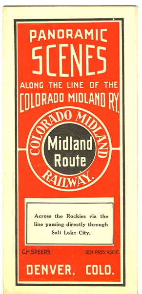
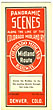
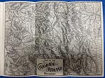
Panoramic Scenes Along The Line Of The Colorado Midland Ry. Across The Rockies Via The Line Passing Directly Through Salt Lake City
Colorado Midland Railway
Other works by Colorado Midland RailwayPublication: Privately printed, nd ca 1900, NP
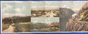
8" x 42" sheet folded to 24 panels, each 8" x 3 1/2." Printed in black and red. Opens to 12 panels of color illustrations to include Pike's Peak, Leadville, Wood's Lake, Mt. Sopris, The Seven Castles, and Glenwood Springs. 3-panel topographic map of the area showing the Colorado Midland Railway lines. 7 panels of descriptions of various destinations to include Salt Lake City, Soldier's Summit, South Canon, Seven Castles, Glen Beulah Park, Manitou, Idlewild, Buena Vista, Evergreen Lakes, Red Rock Canon, Leadville, Hell Gate, Howbert, etc. 2 cover panels. Light soiling to cover panels. Very good plus. A very nice item.
Inventory Number: 39867Sold -- Contact us
![Cowboy Memories: The Writings Of Mrs. Anne Mcaulay LANNING, JIM AND JUDY [EDITED BY]](/media/images/thumb/47400.jpg)