
Dealer in Rare and First-Edition Books: Western Americana; Mystery, Detective, and Espionage Fiction
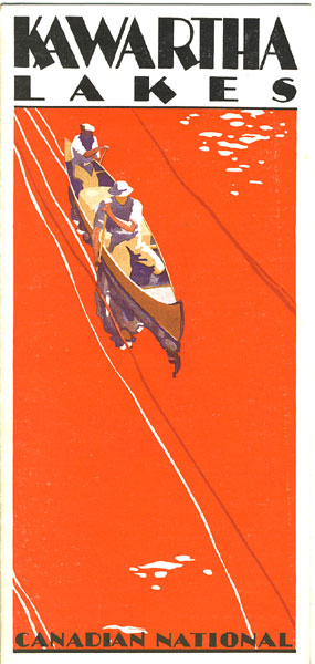
Kawartha Lakes
CANADIAN NATIONAL RAILWAYS
Other works by CANADIAN NATIONAL RAILWAYSPublication: Privately printed, 1927, N P
9" x 24" sheet, folded to 12 panels, illustrated, map. One side provides a 9" x 8" color map of Kawartha Lakes District and Haliburton Highlands reached by Canadian National Railways, and information on Stoney Lake, Burleigh Falls, Buckhorn Lake, Sturgeon Lake, Balsam Lake, Haliburton Highlands, and Rice Lake. The other side contains 3 panels of photographic views of the region, and lists of hotels and boarding houses in the Kawartha Lakes region. Minor rubbing to a few fold creases else a near fine, clean copy.
Inventory Number: 39172Sold -- Contact usRelated Books
![Marriage Records Index 1865-1895 Of Yavapai County, Prescott, Arizona WHITESIDE, DORA M. [COMPILED BY]](/media/images/thumb/46507.jpg)

