Dealer in Rare and First-Edition Books: Western Americana; Mystery, Detective, and Espionage Fiction

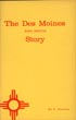
The Routes And Mineral Resources Of North Western Canada
DYER, F. R. G. S., E. JEROME
Other works by DYER, F. R. G. S., E. JEROMEPublication: George Philip & Son, 1898, London
First edition. 8vo. Light blue cloth, titles stamped in gold gilt on the front cover and spine, light yellow colored front and rear endpapers, xx, 268 pp., frontispiece (folding map of the country between the Yukon & Mackenzie Rivers), preface, acknowledgments, three maps (two folding, including a large color map at the end). The large folding color map is titled "A Special Map of British Columbia Showing the Klondike, Cariboo, Kootenay, and Other Gold Fields." This book was published under the auspices of The Incorporated London Chamber of Mines, with which are affiliated the Australasian and Canadian Chambers of Mines, London. A very scarce compilation from other sources describing the mining fields being developed, the routes to the Yukon and the far North West Territories with accounts of the Klondike gold rush, methods of mining, the navigation of the rivers, with distances of routes, the conditions to be encountered and suggested outfits. All page edges uniformly browned, the three maps are in fine condition, interior clean for an overall, attractive, near fine copy of a scarce and important book..
Inventory Number: 39615Sold -- Contact us