Dealer in Rare and First-Edition Books: Western Americana; Mystery, Detective, and Espionage Fiction
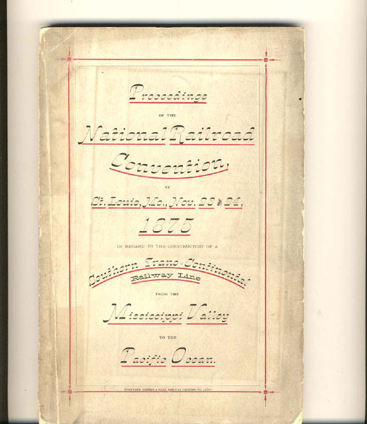
Proceedings Of The National Railroad Convention At St. Louis, Mo., November 23 And 24, 1875, In Regard To The Construction Of The Texas & Pacific Railway As A Southern Trans-Continental Line From The Mississippi Valley To The Pacific Ocean On The Thirty-Second Parallel Of Latitude
JOHN M HARRELL
Other works by JOHN M HARRELLPublication: Woodward, Tiernan & Hale, Printers and Binders, 1875, St Louis
First edition. 8vo. Original printed wrappers, x, 11-208 pp., map, appendix, index. The basis for this construction were several including the mildness of climate minimizes the opportunity for heavy snowfalls, at the highest point in crossing is only 5,000 feet above sea level, springs and streams are numerous, coal beds have been found along the route, the grades are light and the road will traverse for the most part level bottom lands and gradually ascending highlands. The road closely follows the 32nd parallel of latitude and the distance by this route from Fort Worth to San Francisco is 1,851 miles. To San Diego or the Gulf of California would be several hundred miles less, and it is claimed that this is the shortest practicable route to the Pacific coast. A list of the state delegates to the convention is provided. A large folding map is of the United States shows the Texas & Pacific Railway and its connections in 1875. The map is in fine condition. Spine panel reinforced with cellophane tape, a tear to the margin of page ix and 11, else a very good copy.
Inventory Number: 35967Sold -- Contact us