Dealer in Rare and First-Edition Books: Western Americana; Mystery, Detective, and Espionage Fiction
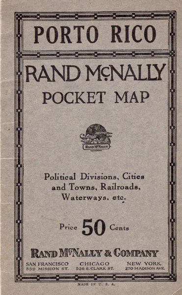
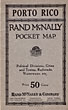

Porto Rico. Rand Mcnally Pocket Map. Political Divisions, Cities And Towns, Railroads, Waterways, Etc
Rand Mcnally & Company
Other works by Rand Mcnally & CompanyPublication: Rand McNally & Company, 1920, Chicago
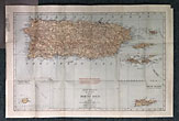
14" x 21" color map of Porto Rico folded and housed in 6 1/2" x 4" thick gray wrappers. Map shows railroads, cities, districts, rivers, etc. Opposite side of map offers Index listing towns, municipalities islands, lakes, mountains, rivers, towns with locations and populations. Inset are 2 maps ... a 3 3/4" x 3 3/4" map of the islands west of Porto Rico and a 6 3/4" x 5 1/2" map of the Virgin Islands. Splits to 2 folds along with small chip missing to to edge. Map has been removed from folder leaving residue to inside wrappers as well as removal of some layers at edge of map but not affecting map. Very good.
Inventory Number: 44212Sold -- Contact us
Related Books

![Wisconsin Central Railroad Lands. COLBY, CHAS L. [LAND COMMISSIONER].](/media/images/thumb/31905.jpg)