Dealer in Rare and First-Edition Books: Western Americana; Mystery, Detective, and Espionage Fiction
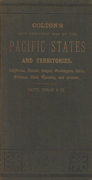
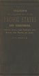
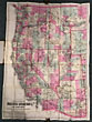
Colton's New Township Map Of The Pacific States And Territories. California, Nevada, Oregon, Washington, Idaho, Montana, Utah, Wyoming, And Arizona. (Cover Title)
COLTON, G, W. AND C, B,
Other works by COLTON, G, W. AND C, B,Publication: G W & C B Colton and Payot, Upham & CO, 1883, New York & San Francisco
Large folding hand-colored map, scale 33 miles\inch. Map is 36" x 28 1/2" folded into 8" x 4" blind and gilt-stamped
brown folder. First and only issue of the last and rarest of Colton’s regional maps of the West. The G. W. & C. B. Colton firm was a prominent family business of mapmakers in the nineteenth century American map trade. The business was founded by Joseph Hutchins Colton (1800-1893). By the 1850’s the firm’s output included original maps, guide books, atlases, etc. Joseph was succeeded by his sons, George Woolworth Colton (1827-1901) and Charles B. Colton (1831-1916). As a result, the firm was renamed G. W. & C. B. Colton. This very fine example of the Colton map, with its original gilt-titled folder, is a wonderful example of Colton’s large format pocket maps and shows the area west of the Rocky Mountains, hand-colored by counties and focusing on the western railroad lines. There is excellent detail along the routes to the various mining regions and the Southern Pacific railroad is shown crossing the entire region to Los Angeles. This map pre-dates the creation of Riverside, Orange and Imperial Counties in California and a large Navajo Indian reservation is shown bordering northeast Arizona and New Mexico. Very rare and very scarce, most especially in this fine and bright condition!
Inventory Number: 46908Sold -- Contact us