
Dealer in Rare and First-Edition Books: Western Americana; Mystery, Detective, and Espionage Fiction
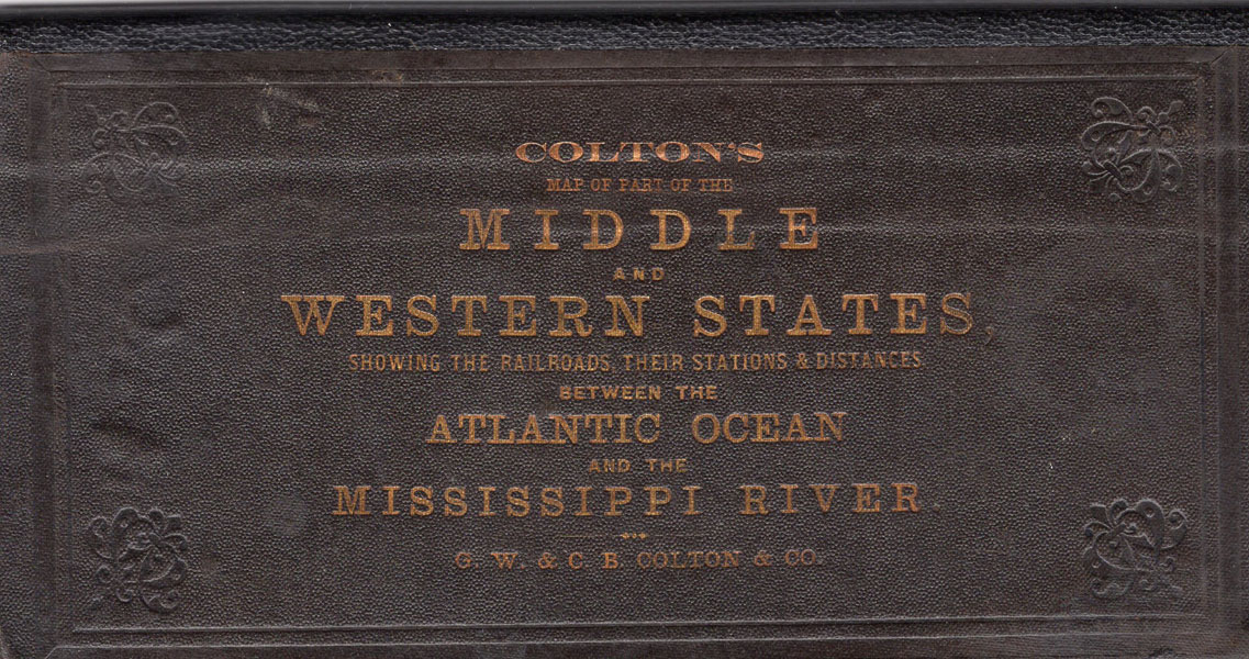
Colton's Map Of Part Of The Middle And Western States, Showing The Railroads, Their Stations & Distances, Between The Atlantic Ocean And The Mississippi River. (Cover Title)
G. W. & C. B. COLTON & CO
Other works by G. W. & C. B. COLTON & COPublication: G W & C B Colton & Co, 1868, New York
First edition.4" x 8" blind stamped, cloth covers with titles stamped in gilt on the front cover, contains two large, folding, colored maps. One map folds out to 21" x 37" and details the Atlantic Ocean westward to include Indiana. The Indiana Central Railway is outlined in red and their connecting lines in blue The other map folds out to 21" x 35" and shows the western portion of Indiana, Illinois, Iowa, Nebraska, Kansas, Missouri, and a portion of Wisconsin. The railway line is colored in red and the connecting lines in blue. A scarce separately issued map of which only four copies are recorded in WorldCat: LOC, University of Michigan, Penn State University, and University of Chicago. Spine panel professionally restored and colored maps show only minimal wear at a few fold points, else a very good, tight copy.
Inventory Number: 45023Sold -- Contact us

![Man Of The West. Reminiscences Of George Washington Oaks, 1840-1917. JAASTAD, BEN [RECORDED BY] & ARTHUR WOODWARD [EDITED AND ANNOTATED BY]](/media/images/thumb/51171.jpg)


