Dealer in Rare and First-Edition Books: Western Americana; Mystery, Detective, and Espionage Fiction
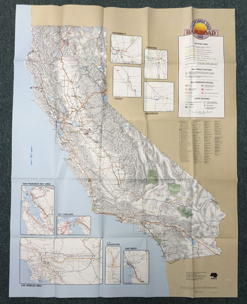
California State Railroad Map
CALTRANS DIVISION OF MASS TRANSPORTATION
Other works by CALTRANS DIVISION OF MASS TRANSPORTATIONPublication: Published by Caltrans Division of Mass Transportation, 1982, Sacramento
First edition. 35" x 46" full color map of California. Map details the railroad companies that serve the state of which five are national companies, the locations of rail passenger stations, rail freight features, military reservations requiring rail service, etc. Several inset maps are provided for the San Francisco Bay area, San Francisco / Oakland, the Los Angeles area, downtown Los Angeles, San Diego, Fresno, Bakersfield, Stockton, and Sacramento. Map is folded to a 9 1/4" x 7 1/4" size and is in fine, unused condition. An attractive item.
Inventory Number: 45697Sold -- Contact us