Dealer in Rare and First-Edition Books: Western Americana; Mystery, Detective, and Espionage Fiction
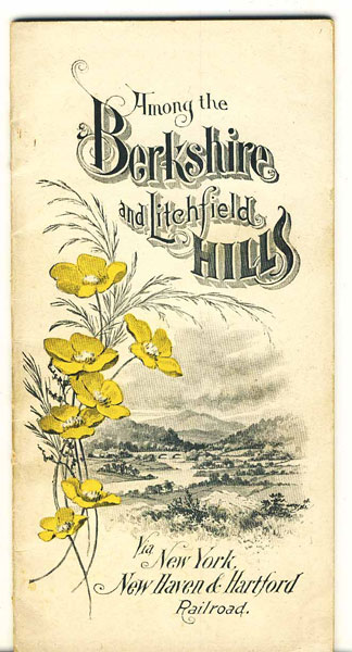
Among The Berkshire And Litchfield Hills Via New York, New Haven & Hartford Railroad
NEW YORK, NEW HAVEN & HARTFORD RAILROAD
Other works by NEW YORK, NEW HAVEN & HARTFORD RAILROADPublication: Rand Avery Supply Co, 1904, Boston
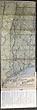
First edition. 8" X 4" color, pictorial, stiff, wrappers, 39 [1] pp., illustrated (mostly from photographs), folding map affixed to the inside rear cover. 8" x 24" folding map is in color and in fine, unused condition. It is a sectional map of the N. Y., N. H. & H. Berkshire Hills Route which leaves from New York City and travels to a few stations in New York, then on to stations in Connecticut and Massachusetts. Much descriptive text is provided, which is artistically illustrated with numerous black & white photographs. Towns such as Norwalk, Ridgefield, New Preston, Washington, Litchfield, New Milford, West Cornwall, Canaan, Sheffield, Great Barrington, Stockbridge, Lenox, Pittsfield, etc. are discussed in some depth including area lakes, homes of note, etc. An exceptional item with much of interest about the railroad and the area traversed. Cream-colored covers lightly soiled, else a very good copy.
Inventory Number: 40363Sold -- Contact us